Category:Oriel Chambers, Kingston upon Hull
Jump to navigation
Jump to search
| Object location | | View all coordinates using: OpenStreetMap |
|---|
building in City of Kingston upon Hull, East Riding of Yorkshire, UK  | |||||
| Upload media | |||||
| Instance of | |||||
|---|---|---|---|---|---|
| Location | City of Kingston upon Hull, East Riding of Yorkshire, Yorkshire and the Humber, England | ||||
| Occupant |
| ||||
| Heritage designation |
| ||||
 | |||||
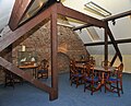
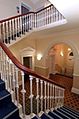
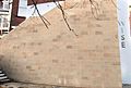
Media in category "Oriel Chambers, Kingston upon Hull"
The following 8 files are in this category, out of 8 total.
-
 Names on wall.png 960 × 639; 1.28 MB
-
 Oriel Chambers, Hull.jpeg 540 × 960; 94 KB
-
 Oriel2.png 796 × 597; 1.06 MB
-
 Oriel3.png 476 × 629; 654 KB
-
 Oriel5.png 808 × 699; 1.36 MB
-
 Top board.jpg 668 × 540; 60 KB
-
 Wise conferences facilities.jpg 229 × 345; 17 KB
-
 Wisewall.jpg 819 × 552; 112 KB


